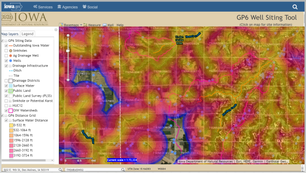
NEW - GP6 Well Siting Tool
The Iowa DNR recently developed an online GP6 Well Siting Tool to assist landowners, well contractors, and engineers.
The tool is useful for performing desk evaluations of well sites and help determine if the well location will likely require discharge management through GP6. It also helps define which locations likely cannot support well construction discharge due to close proximity of Outstanding Iowa Waters (OIWs).
As a user of this tool, you have access to map layers that will help you identify distances to surface waters and OIWs, locations of sinkholes, karst areas, land slope, and more. It also allows you to print the map you create to use as a resource.
The GP6 Well Siting Tool works with Google Chrome and Mozilla Firefox web browsers. Currently, it is not compatible with Internet Explorer. To open and use the GP6 Well Siting Tool, click on the following link: https://programs.iowadnr.gov/maps/gp6/.
To learn more about GP6 and the resources available to help you comply, please click on the following link: www.iowadnr.gov/GP6.