Pre-Processed Meteorological Data for AERMOD
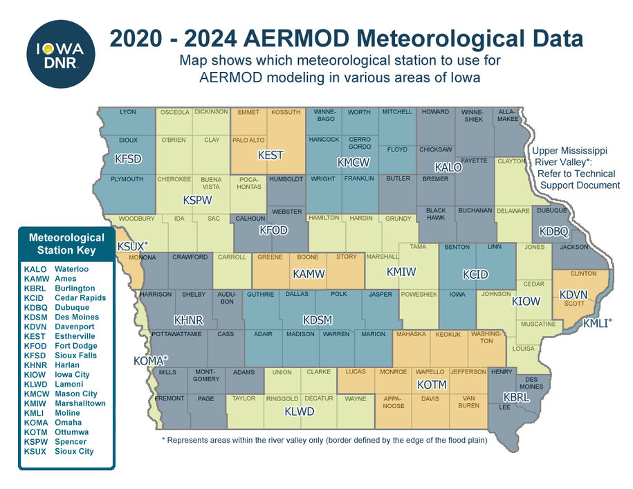
The following map depicts which meteorological stations are considered representative of each county in the state as they apply to the AERMOD air dispersion model. Use the links at the bottom of the page to download the latest pre-processed (model-ready) Iowa DNR approved meteorological data for use in AERMOD. The meteorological data period is updated every five years (last updated in 2025). If EPA makes changes to AERMET, the meteorological preprocessor for AERMOD, revised versions of the data may be released. Data versions are denoted by the letter appended to the end of each data filename.
Downloads
- Meteorological Data Representativity Map (160.18 KB) .pdf
- Meteorological Data Representativity List (198.02 KB) .pdf
- 2020 - 2024 AERMOD Met Data Technical Support Document (1.25 MB) .pdf
- Quantifying Terrain Influence on Wind for Dispersion Modeling (1.77 MB) Archived .pdf
2020-2024 - Version A (released 1/30/2026)
- Ames (.zip file)
- Burlington (.zip file)
- Cedar Rapids (.zip file)
- Davenport (.zip file)
- Des Moines (.zip file)
- Dubuque (.zip file)
- Estherville (.zip file)
- Fort Dodge (.zip file)
- Harlan (.zip file)
- Iowa City (.zip file)
- Lamoni (.zip file)
- Marshalltown (.zip file)
- Mason City (.zip file)
- Moline (.zip file)
- Omaha (.zip file)
- Ottumwa (.zip file)
- Sioux City (.zip file)
- Sioux Falls (.zip file)
- Spencer (.zip file)
- Waterloo (.zip file)