On this page...

Visit one of Iowa's trout hatcheries during your next trip to northeast Iowa - Manchester, Chuck Gipp Decorah or Big Spring.
Welcome to Iowa Trout Country!
Plenty of opportunities await trout anglers in Iowa:
- 48 catchable-stocked rainbow trout fisheries on publicly-accessible streams and ponds
- 10 special trout fisheries with restrictive regulations
- 18 community trout fisheries
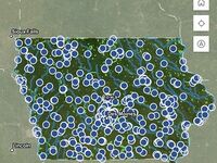
- More than 50 wild, self-sustaining trout fisheries throughout northeast Iowa
Catchable Trout Streams
The Iowa DNR stocks more than 300,000 catchable-sized rainbow trout in 50 Northeast Iowa streams each year from April through October. More than 600 extra brood trout, weighing over 2 pounds each, are also released in small numbers into each stream. The number of trout stocked into each area varies, depending on length of the stream and how many anglers use the area. These criteria also determine how often each area is stocked.
Surveys show there are still good numbers of trout several days after the most recent stocking and throughout the winter. Along with the stocked trout, many areas have good to excellent numbers of wild brown trout that challenge even the best anglers. Brown trout up to 20 inches are possible.
Trout streams will receive both announced and unannounced stockings. There has been no change to the frequency of stockings or the number of fish stocked at any of our trout streams. Moving to unannounced stockings has given DNR fisheries staff more flexibility in completing the stockings and improving efficiency. This has allowed for improved stream access (mowing) and hatchery maintenance, completing projects around the hatchery and planning for stream improvement projects that they otherwise didn't have the time to complete.
Almost all of the streams in Northeast Iowa have natural reproduction of brown trout and several have natural reproduction of brook trout. Streams with brown trout reproduction have populations that range from 500 to 2,000 fish per mile that rival driftless streams in Minnesota or Wisconsin.

You Shared. We Listened.
More than 3,550 Iowa trout anglers participated in the 2021 Trout Angler Survey. We apprecitate their feedback and support to help us provide the best quality trout fishing for Iowa anglers.
Trout Hatcheries
The grounds to each facility are open to the public year round from sunrise to sunset.
View all Iowa fish hatcheries.
Back to topCold-water Stream Fish
Back to topHow to...
- Get a trout fishing license
- Fish for trout
- Clean and cook a fish
- Catch and release fish
- Rod & Reel Cleaning
- Spawning & Fertilization
Browse hundreds of river accesses and county and state managed lake contours, miles of trout streams, over 2,000 fish structures, community fishing ponds, and Mississippi River Lock and Dam locations.